
Marshall topographic map
Click on the map to display elevation.
About this map
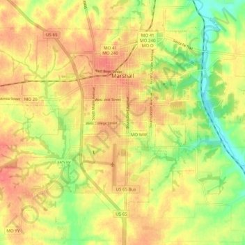
Name: Marshall topographic map, elevation, terrain.
Location: Marshall, Saline County, Missouri, 65340, United States (39.07915 -93.25923 39.13771 -93.16124)
Average elevation: 745 ft
Minimum elevation: 633 ft
Maximum elevation: 817 ft
Saline County trails, hiking, mountain biking, running and outdoor activities
Other topographic maps
Click on a map to view its topography, its elevation and its terrain.