
Make a donation
Gear up for your next adventure:
As an Amazon Associate, this site earns from qualifying purchases at no extra cost to you.
Honey Brook topographic map
Click on the map to display elevation.
Make a donation
Gear up for your next adventure:
As an Amazon Associate, this site earns from qualifying purchases at no extra cost to you.
About this map
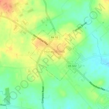
Name: Honey Brook topographic map, elevation, terrain.
Location: Honey Brook, Chester County, Pennsylvania, United States (40.08703 -75.91940 40.10004 -75.90296)
Average elevation: 699 ft
Minimum elevation: 633 ft
Maximum elevation: 781 ft
Make a donation
Gear up for your next adventure:
As an Amazon Associate, this site earns from qualifying purchases at no extra cost to you.
Other topographic maps
Click on a map to view its topography, its elevation and its terrain.
Strafford
United States > Pennsylvania > Chester County > Tredyffrin Township
Average elevation: 436 ft
Longwood Gardens
United States > Pennsylvania > Chester County > East Marlborough Township
Average elevation: 410 ft
Nottingham County Park
United States > Pennsylvania > Chester County > West Nottingham Township
Average elevation: 449 ft
Valley Forge
United States > Pennsylvania > Chester County > Schuylkill Township
Average elevation: 256 ft
Make a donation
Gear up for your next adventure:
As an Amazon Associate, this site earns from qualifying purchases at no extra cost to you.
Nottingham
United States > Pennsylvania > Chester County > West Nottingham Township
Average elevation: 476 ft
Wagontown
United States > Pennsylvania > Chester County > West Caln Township
Average elevation: 545 ft
Make a donation
Gear up for your next adventure:
As an Amazon Associate, this site earns from qualifying purchases at no extra cost to you.
East Nantmeal
United States > Pennsylvania > Chester County > East Nantmeal Township
Average elevation: 646 ft
Freemont
United States > Pennsylvania > Chester County > West Nottingham Township
Average elevation: 377 ft
Knickerbocker
United States > Pennsylvania > Chester County > Willistown Township
Average elevation: 417 ft
Bondsville
United States > Pennsylvania > Chester County > East Brandywine Township
Average elevation: 492 ft
Make a donation
Gear up for your next adventure:
As an Amazon Associate, this site earns from qualifying purchases at no extra cost to you.
Exton
United States > Pennsylvania > Chester County > West Whiteland Township
Average elevation: 410 ft
Baptist Hill
United States > Pennsylvania > Chester County > Tredyffrin Township
Average elevation: 335 ft
Saint Peters
United States > Pennsylvania > Chester County > Warwick Township
Average elevation: 515 ft
Ship Road
United States > Pennsylvania > Chester County > West Whiteland Township > Exton
Average elevation: 436 ft
Make a donation
Gear up for your next adventure:
As an Amazon Associate, this site earns from qualifying purchases at no extra cost to you.
Whitehorse
United States > Pennsylvania > Chester County > Willistown Township
Average elevation: 384 ft
Reeceville
United States > Pennsylvania > Chester County > West Brandywine Township
Average elevation: 554 ft
Make a donation
Gear up for your next adventure:
As an Amazon Associate, this site earns from qualifying purchases at no extra cost to you.
Baptism Creek Spring
United States > Pennsylvania > Chester County > North Coventry Township
Average elevation: 748 ft
Barnsley
United States > Pennsylvania > Chester County > East Nottingham Township
Average elevation: 509 ft
Copesville
United States > Pennsylvania > Chester County > East Bradford Township
Average elevation: 302 ft
Make a donation
Gear up for your next adventure:
As an Amazon Associate, this site earns from qualifying purchases at no extra cost to you.
Valley Forge
United States > Pennsylvania > Chester County > Schuylkill Township
Average elevation: 256 ft
Grove
United States > Pennsylvania > Chester County > West Whiteland Township
Average elevation: 420 ft
Martins Corner
United States > Pennsylvania > Chester County > West Caln Township
Average elevation: 696 ft
Paoli
United States > Pennsylvania > Chester County > Tredyffrin Township > Paoli
Average elevation: 420 ft
Make a donation
Gear up for your next adventure:
As an Amazon Associate, this site earns from qualifying purchases at no extra cost to you.
Nottingham
United States > Pennsylvania > Chester County > West Nottingham Township > Nottingham
Average elevation: 476 ft