Geolocate

North Judson topographic map

Click on the map to display elevation.

About this map

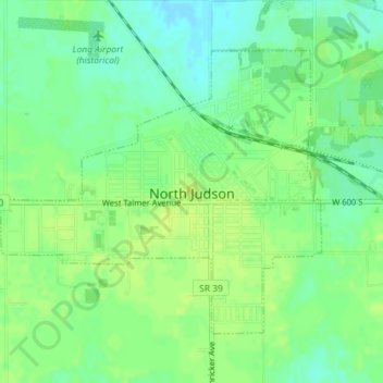
Name: North Judson topographic map, elevation, terrain.

Location: North Judson, Starke County, Indiana, 46366, United States (41.20583 -86.79552 41.22578 -86.76547)

Average elevation: 705 ft

Minimum elevation: 676 ft

Maximum elevation: 725 ft

Starke County trails, hiking, mountain biking, running and outdoor activities

Other topographic maps

Click on a map to view its topography, its elevation and its terrain.

Grovertown

United States > Indiana > Starke County > Grovertown

Average elevation: 725 ft

Gear up for your next adventure:

🏥Hiking First Aid Kits - Comprehensive medical kits for remote trail injuries
GPS Sports Watch - GPS watch for running, hiking and training
📡Handheld GPS Device - Reliable handheld GPS for outdoor navigation
🪓Survival Multi‑Tool - Versatile tool for camp and trail tasks
📡GPS Antenna Upgrade - Enhance GPS reception in remote terrain

As an Amazon Associate, this site earns from qualifying purchases at no extra cost to you.