
Lind topographic map
Click on the map to display elevation.
About this map
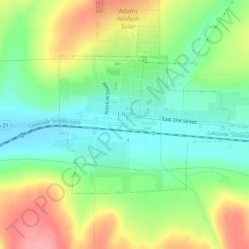
Name: Lind topographic map, elevation, terrain.
Location: Lind, Adams County, Washington, United States (46.96343 -118.62665 46.97837 -118.58958)
Average elevation: 1,473 ft
Minimum elevation: 1,332 ft
Maximum elevation: 1,683 ft
Adams County trails, hiking, mountain biking, running and outdoor activities
Other topographic maps
Click on a map to view its topography, its elevation and its terrain.