
Galloway topographic map
Click on the map to display elevation.
About this map
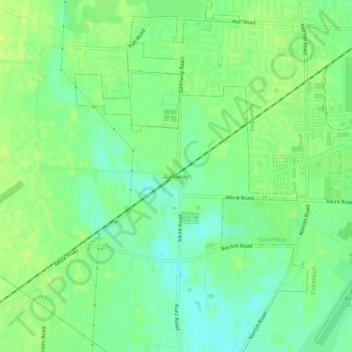
Name: Galloway topographic map, elevation, terrain.
Average elevation: 906 ft
Minimum elevation: 876 ft
Maximum elevation: 928 ft
Franklin County trails, hiking, mountain biking, running and outdoor activities
Other topographic maps
Click on a map to view its topography, its elevation and its terrain.
Columbus
United States > Ohio > Franklin County
Columbus is situated in the rolling hills of the Central Lowlands region, characterized by a predominantly flat to gently undulating terrain. The city itself is nestled on the banks of the Scioto River, which flows northward through the area, providing a picturesque waterfront and a variety of recreational…
Average elevation: 856 ft
Dublin
United States > Ohio > Franklin County
Located on the Glaciated Allegheny Plateau, Dublin has a relatively flat topography. Nevertheless, there are numerous ravines surrounding the tributaries of the Scioto River, which make for steep cliffs in some areas. Elevations range from 780 feet (240 m) above sea level where the Scioto River leaves the city…
Average elevation: 902 ft
Upper Arlington
United States > Ohio > Franklin County
The city is around 800 ft elevation located between the Olentangy and Scioto rivers. Two ravines cut through the city. The Slate Run in the northwest corner flows into the Scioto River. However, the Turkey Run is longer. It originates in the north then runs southwards until it makes an eastward bend around…
Average elevation: 817 ft
New Albany
United States > Ohio > Franklin County
New Albany is located in northeastern Franklin County at 40°4′43″N 82°49′14″W / 40.07861°N 82.82056°W / 40.07861; -82.82056 (40.078643, −82.820618), with a portion extending east into Licking County. It is northeast of Columbus at an elevation of 1,024 feet (312 m).
Average elevation: 1,033 ft
Dublin
United States > Ohio > Franklin County
Located on the Glaciated Allegheny Plateau, Dublin has a relatively flat topography. Nevertheless, there are numerous ravines surrounding the tributaries of the Scioto River, which make for steep cliffs in some areas. Elevations range from 780 feet (240 m) above sea level where the Scioto River leaves the city…
Average elevation: 902 ft
Columbus
United States > Ohio > Franklin County
The confluence of the Scioto and Olentangy rivers is just northwest of Downtown Columbus. Several smaller tributaries course through the Columbus metropolitan area, including Alum Creek, Big Walnut Creek and Darby Creek. Columbus is considered to have relatively flat topography thanks to a large glacier that…
Average elevation: 856 ft