
Buladean topographic map
Click on the map to display elevation.
About this map
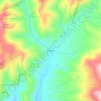
Name: Buladean topographic map, elevation, terrain.
Location: Buladean, Mitchell County, North Carolina, United States (36.08845 -82.21485 36.12845 -82.17485)
Average elevation: 3,255 ft
Minimum elevation: 2,644 ft
Maximum elevation: 4,268 ft
Mitchell County trails, hiking, mountain biking, running and outdoor activities
Other topographic maps
Click on a map to view its topography, its elevation and its terrain.
North Toe River
United States > North Carolina > Mitchell County > Spruce Pine
Average elevation: 2,703 ft