Geolocate

York topographic map

Click on the map to display elevation.

About this map

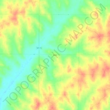
Name: York topographic map, elevation, terrain.

Location: York, Atchison County, Missouri, United States (40.38777 -95.28553 40.42777 -95.24553)

Average elevation: 1,053 ft

Minimum elevation: 961 ft

Maximum elevation: 1,138 ft

Atchison County trails, hiking, mountain biking, running and outdoor activities

Other topographic maps

Click on a map to view its topography, its elevation and its terrain.

Tarkio

United States > Missouri > Atchison County

Average elevation: 958 ft

Fairfax

United States > Missouri > Atchison County

Average elevation: 938 ft

Westboro

United States > Missouri > Atchison County

Average elevation: 1,033 ft

Watson

United States > Missouri > Atchison County

Average elevation: 902 ft

Nishnabotna

United States > Missouri > Atchison County

Average elevation: 961 ft

Gear up for your next adventure:

🩹Survival Bandages - High‑quality bandages for emergencies
Backpacking Tent - Lightweight and durable tent for multi‑day hikes
🔦Compact Flashlight - Reliable flashlight for emergencies
🎒Day Hiking Backpack - Lightweight backpack perfect for day trips and outdoor adventures
🗺️Topographic Maps - Detailed topo maps for hiking, exploring and outdoor navigation

As an Amazon Associate, this site earns from qualifying purchases at no extra cost to you.