
Make a donation
Gear up for your next adventure:
As an Amazon Associate, this site earns from qualifying purchases at no extra cost to you.
De Soto topographic map
Click on the map to display elevation.
Make a donation
Gear up for your next adventure:
As an Amazon Associate, this site earns from qualifying purchases at no extra cost to you.
About this map
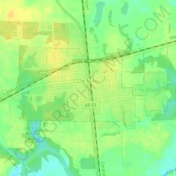
Name: De Soto topographic map, elevation, terrain.
Location: De Soto, Jackson County, Illinois, United States (37.81019 -89.24344 37.82266 -89.21086)
Average elevation: 394 ft
Minimum elevation: 348 ft
Maximum elevation: 427 ft
Jackson County trails, hiking, mountain biking, running and outdoor activities
Make a donation
Gear up for your next adventure:
As an Amazon Associate, this site earns from qualifying purchases at no extra cost to you.
Other topographic maps
Click on a map to view its topography, its elevation and its terrain.
Lake Shore Drive Area
United States > Illinois > Jackson County > Carbondale
Average elevation: 440 ft