
月湖村 topographic map
Interactive map
Click on the map to display elevation.
About this map
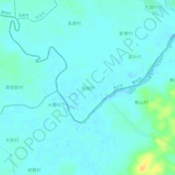
Name: 月湖村 topographic map, elevation, terrain.
Location: 月湖村, 揭阳市, 广东省, 中国 (22.91572 115.96095 22.95572 116.00095)
Average elevation: 16 ft
Minimum elevation: -7 ft
Maximum elevation: 85 ft
Other topographic maps
Click on a map to view its topography, its elevation and its terrain.