Geolocate

Castine topographic map

Click on the map to display elevation.

About this map

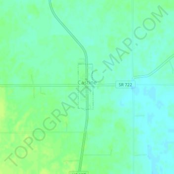
Name: Castine topographic map, elevation, terrain.

Location: Castine, Darke County, Ohio, United States (39.92738 -84.62626 39.93458 -84.62319)

Average elevation: 1,079 ft

Minimum elevation: 1,060 ft

Maximum elevation: 1,106 ft

Darke County trails, hiking, mountain biking, running and outdoor activities

Other topographic maps

Click on a map to view its topography, its elevation and its terrain.

Union Corners

United States > Ohio > Darke County

Average elevation: 1,010 ft

Webster

United States > Ohio > Darke County

Average elevation: 991 ft

Horatio

United States > Ohio > Darke County

Average elevation: 1,010 ft

Abbottsville

United States > Ohio > Darke County

Average elevation: 1,050 ft

Hill Grove

United States > Ohio > Darke County

Average elevation: 1,073 ft

Delisle

United States > Ohio > Darke County

Average elevation: 1,053 ft

Gear up for your next adventure:

Backpacking Tents - Weight-optimized shelters for multi-day topographic surveys
📱Heavy-Duty Phone Cases - Drop-proof and waterproof protection for outdoor navigation
🛶Inflatable Kayak - Portable kayak for rivers, lakes, and expeditions
🩳Quick‑Dry Hiking Shorts - Comfortable and quick‑dry shorts for summer hiking
🪄Magnetic Compass - Accurate compass for navigation

As an Amazon Associate, this site earns from qualifying purchases at no extra cost to you.