Geolocate

Noon topographic map

Click on the map to display elevation.

About this map

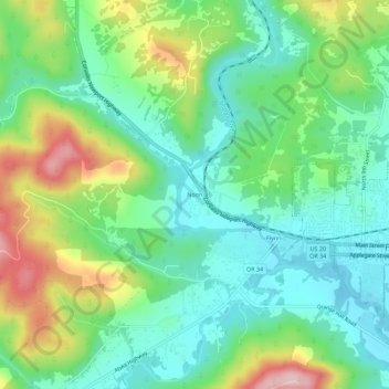
Name: Noon topographic map, elevation, terrain.

Location: Noon, Benton County, Oregon, 97370, United States (44.52540 -123.41816 44.56540 -123.37816)

Average elevation: 469 ft

Minimum elevation: 236 ft

Maximum elevation: 958 ft

Benton County trails, hiking, mountain biking, running and outdoor activities

Other topographic maps

Click on a map to view its topography, its elevation and its terrain.

Monroe

United States > Oregon > Benton County

Average elevation: 325 ft

Gear up for your next adventure:

GPS Sports Watch - GPS watch for running, hiking and training
👓Polarized Sunglasses - Outdoor sunglasses for glare reduction
🎒Trekking Poles - Sturdy poles for balance and stability on rough terrain
📷Action Cameras - Rugged cameras to document your journeys across rugged terrain
🎒Day Hiking Backpack - Lightweight backpack perfect for day trips and outdoor adventures

As an Amazon Associate, this site earns from qualifying purchases at no extra cost to you.