
Make a donation
Gear up for your next adventure:
As an Amazon Associate, this site earns from qualifying purchases at no extra cost to you.
Höge topographic map
Click on the map to display elevation.
Make a donation
Gear up for your next adventure:
As an Amazon Associate, this site earns from qualifying purchases at no extra cost to you.
About this map
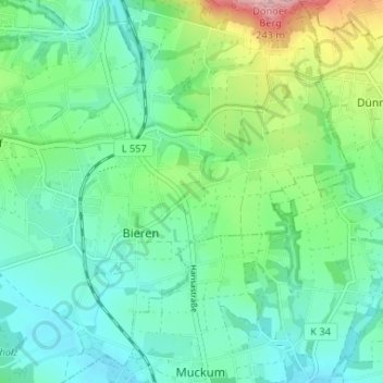
Name: Höge topographic map, elevation, terrain.
Average elevation: 374 ft
Minimum elevation: 233 ft
Maximum elevation: 781 ft
Make a donation
Gear up for your next adventure:
As an Amazon Associate, this site earns from qualifying purchases at no extra cost to you.
Other topographic maps
Click on a map to view its topography, its elevation and its terrain.
Rödinghausen
Deutschland > Nordrhein-Westfalen > Kreis Herford > Rödinghausen
Der Ortsteil Rödinghausen liegt am Südrand des Wiehengebirges im Ravensberger Hügelland. Streng genommen gehört ein sehr kleiner Teil des Eggetals (Gehle) nördlich des Kamms des Wiehengebirges auch zum Ortsteil. Der Nonnenstein im Norden des Ortsteils ist mit 274 m ü. NN zugleich die höchste Erhebung…
Average elevation: 499 ft
Schwenningdorf
Deutschland > Nordrhein-Westfalen > Kreis Herford > Rödinghausen
Der Ortsteil Schwenningdorf liegt im Norden Rödinghausens an den Hängen des Wiehengebirges. Höchster Berg ist der Maschberg mit 190 m ü. NN Höhe. Tiefste Niederung ist das Tal der Großen Aue auf rund 80 m ü. NN. Schwenningdorf hat etwa 2356 Einwohner und eine Fläche von 7,449 km² (316 Einwohner pro…
Average elevation: 440 ft
Ostkilver
Deutschland > Nordrhein-Westfalen > Kreis Herford > Rödinghausen
Ostkilver liegt im Südwesten Rödinghausens auf einer Höhe zwischen 120 m ü. NN und 68 m ü. NN. Der tiefste Punkt Ostkilvers in den Elseauen ist zugleich der tiefste Punkt der Gemeinde Rödinghausen. Die Else durchfließt den Ortsteil im Süden von West nach Ost. Ostkilver hat rund 1900 Einwohner, die auf…
Average elevation: 308 ft