Geolocate

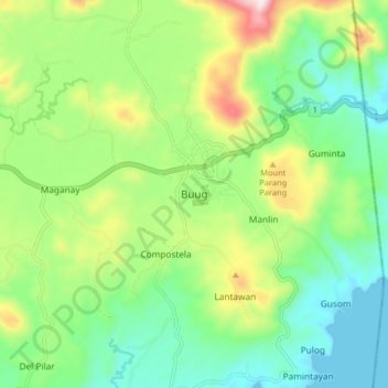
Buug topographic map

Click on the map to display elevation.

Buug

It has an average temperature of 26 °C (79 °F) and has an average elevation of 200 metres (660 ft) above sea level. It is away from the typhoon belt and enjoying a Type IV climate, i.e. rainfall is more or less evenly distributed throughout the year.

Wikipedia (CC-BY-SA 3.0)

About this map

Name: Buug topographic map, elevation, terrain.

Location: Buug, Zamboanga Sibugay, Zamboanga Peninsula, 7009, Philippines (7.69094 123.01987 7.77094 123.09987)

Average elevation: 643 ft

Minimum elevation: 0 ft

Maximum elevation: 1,824 ft

Other topographic maps

Click on a map to view its topography, its elevation and its terrain.

Olutanga Island

Philippines > Zamboanga Sibugay

Average elevation: 23 ft

Payao

Philippines > Zamboanga Sibugay > Payao

Average elevation: 66 ft

Gear up for your next adventure:

🕶️GPS Smartphone Mount - Secure mount for phone navigation
🥄Camping Utensil Set - Lightweight utensils for outdoor meals
🔭Compact Binoculars - HD vision for scouting terrain and identifying distant landmarks
🛶Inflatable Kayak - Portable kayak for rivers, lakes, and expeditions
🩹Survival Bandages - High‑quality bandages for emergencies

As an Amazon Associate, this site earns from qualifying purchases at no extra cost to you.