Geolocate

Langley topographic map

Click on the map to display elevation.

About this map

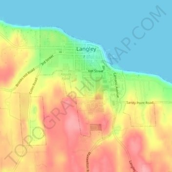
Name: Langley topographic map, elevation, terrain.

Location: Langley, Island County, Washington, United States (48.02472 -122.42704 48.04352 -122.38721)

Average elevation: 157 ft

Minimum elevation: 0 ft

Maximum elevation: 338 ft

Island County trails, hiking, mountain biking, running and outdoor activities

Other topographic maps

Click on a map to view its topography, its elevation and its terrain.

Puget Sound

United States > Washington > Island County

Average elevation: 0 ft

Freeland

United States > Washington > Island County

Average elevation: 121 ft

Clinton

United States > Washington > Island County

Average elevation: 157 ft

Bayview

United States > Washington > Island County

Average elevation: 154 ft

Cornet

United States > Washington > Island County

Average elevation: 177 ft

Glendale

United States > Washington > Island County

Average elevation: 144 ft

Keystone

United States > Washington > Island County

Average elevation: 7 ft

Mabana

United States > Washington > Island County

Average elevation: 75 ft

Maxwelton

United States > Washington > Island County

Average elevation: 89 ft

San de Fuca

United States > Washington > Island County

Average elevation: 102 ft

Long Beach

United States > Washington > Island County

Average elevation: 36 ft

Gear up for your next adventure:

🌡️Handheld Weather Meters - Measure wind, temp, and pressure for safe mountain travel
🔪Outdoor Multitools - Essential survival tools for gear repair and field use
🧢Outdoor Hiking Hat - Sun protection hat for outdoor explorers
🧴Hand Sanitizer - Keep hands clean while hiking
🦺Reflective Outdoor Gear - Safety gear for low‑light conditions

As an Amazon Associate, this site earns from qualifying purchases at no extra cost to you.