
Bayview topographic map
Click on the map to display elevation.
About this map
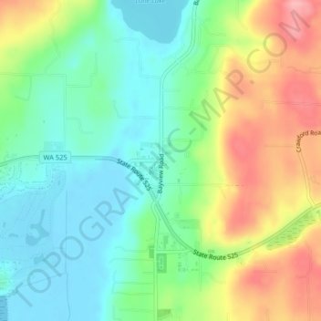
Name: Bayview topographic map, elevation, terrain.
Location: Bayview, Island County, Washington, 98260, United States (47.99770 -122.47105 48.01770 -122.45105)
Average elevation: 154 ft
Minimum elevation: -3 ft
Maximum elevation: 413 ft
Island County trails, hiking, mountain biking, running and outdoor activities
Other topographic maps
Click on a map to view its topography, its elevation and its terrain.
Whidbey Island
United States > Washington > Island County
Whidbey Island features a diverse topography characterized by a mix of rolling hills, lush forests, and dramatic coastal cliffs. The island stretches approximately 55 miles in length and up to 12 miles wide, rising to elevations of about 500 feet at its highest point. Its terrain includes expansive farmland…
Average elevation: 148 ft
Whidbey Island
United States > Washington > Island County
Whidbey Island lies partially in the rain shadow of the Olympic Mountain Range to the west, and has a variety of climate zones. This can be observed by rainfall amounts – wettest in the south with average rainfall of 36 inches (910 mm), driest in the central district of Coupeville with average rainfall of 20…
Average elevation: 148 ft