Geolocate

Hansen topographic map

Click on the map to display elevation.

About this map

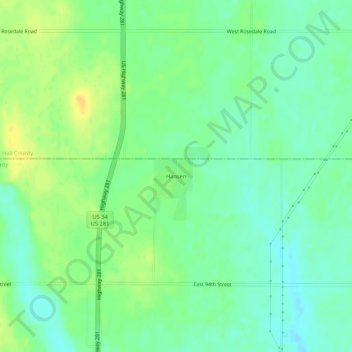
Name: Hansen topographic map, elevation, terrain.

Location: Hansen, Adams County, Nebraska, United States (40.67640 -98.39034 40.71640 -98.35034)

Average elevation: 1,949 ft

Minimum elevation: 1,913 ft

Maximum elevation: 1,995 ft

Adams County trails, hiking, mountain biking, running and outdoor activities

Other topographic maps

Click on a map to view its topography, its elevation and its terrain.

Juniata

United States > Nebraska > Adams County

Average elevation: 1,978 ft

Kenesaw

United States > Nebraska > Adams County

Average elevation: 2,054 ft

Heartwell Lake

United States > Nebraska > Adams County > Hastings

Average elevation: 1,926 ft

Gear up for your next adventure:

🦺Reflective Outdoor Gear - Safety gear for low‑light conditions
🥇GPS Hiking Watch - Multi‑sport GPS watch with navigation and trail tracking
📌Outdoor GPS Map App - Apps and devices for digital topographic navigation
🦶Hiking Gaiters - Keep debris and water out of your boots
🪶Trail Camera - Capture wildlife on your hikes

As an Amazon Associate, this site earns from qualifying purchases at no extra cost to you.