Geolocate

Rogerson topographic map

Click on the map to display elevation.

About this map
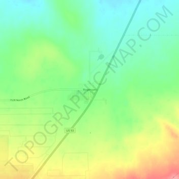
Name: Rogerson topographic map, elevation, terrain.

Location: Rogerson, Twin Falls County, Idaho, United States (42.19797 -114.61420 42.23797 -114.57420)

Average elevation: 4,915 ft

Minimum elevation: 4,797 ft

Maximum elevation: 5,092 ft

Twin Falls County trails, hiking, mountain biking, running and outdoor activities

Other topographic maps

Click on a map to view its topography, its elevation and its terrain.

Twin Falls

United States > Idaho > Twin Falls County

Average elevation: 3,734 ft

Twin Falls

United States > Idaho > Twin Falls County

Average elevation: 3,734 ft

Buhl

United States > Idaho > Twin Falls County

Average elevation: 3,770 ft

Twin Falls

United States > Idaho > Twin Falls County

Average elevation: 3,734 ft

Gear up for your next adventure:

🔦Compact Flashlight - Reliable flashlight for emergencies
🪑Ultralight Camp Chairs - Portable seating for resting after a long day of mapping
🧤Hiking Gloves - Protective gloves for rugged trails
🪶LED Camping Lantern - Bright lantern for camp lighting
🔋Rechargeable Batteries - Power up your outdoor devices

As an Amazon Associate, this site earns from qualifying purchases at no extra cost to you.