Geolocate

Pine Valley topographic map

Click on the map to display elevation.

About this map

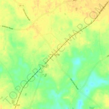
Name: Pine Valley topographic map, elevation, terrain.

Location: Pine Valley, Cook County, Georgia, United States (31.06741 -83.49322 31.10741 -83.45322)

Average elevation: 220 ft

Minimum elevation: 157 ft

Maximum elevation: 256 ft

Cook County trails, hiking, mountain biking, running and outdoor activities

Other topographic maps

Click on a map to view its topography, its elevation and its terrain.

Cecil

United States > Georgia > Cook County

Average elevation: 226 ft

Lenox

United States > Georgia > Cook County

Average elevation: 272 ft

Adel

United States > Georgia > Cook County

Average elevation: 236 ft

Gear up for your next adventure:

🎒Outdoor Daypacks - Lightweight backpacks designed for carrying maps and essential gear
🏕️Tent Footprint - Protect your tent base from wear
🎒Trail Energy Bars - High‑calorie bars for hiking energy
🎁Geography Themed Gifts - Unique gift ideas for map lovers and geography enthusiasts
🎒Gear Packing Cubes - Organize your backpack efficiently

As an Amazon Associate, this site earns from qualifying purchases at no extra cost to you.