Geolocate

Amboy topographic map

Click on the map to display elevation.

About this map

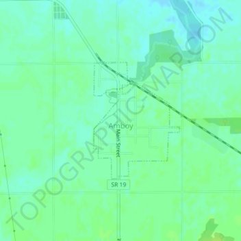
Name: Amboy topographic map, elevation, terrain.

Location: Amboy, Miami County, Indiana, United States (40.59545 -85.93291 40.60852 -85.92020)

Average elevation: 823 ft

Minimum elevation: 804 ft

Maximum elevation: 840 ft

Miami County trails, hiking, mountain biking, running and outdoor activities

Other topographic maps

Click on a map to view its topography, its elevation and its terrain.

Erie

United States > Indiana > Miami County

Average elevation: 784 ft

Miami

United States > Indiana > Miami County

Average elevation: 807 ft

Gear up for your next adventure:

🧷Carabiner Set - Durable clips for gear attachment
🔭Compact Binoculars - HD vision for scouting terrain and identifying distant landmarks
🪶LED Camping Lantern - Bright lantern for camp lighting
🥾Men's Hiking Boots - Durable, waterproof footwear for rugged terrain and steep inclines
📡GPS Antenna Upgrade - Enhance GPS reception in remote terrain

As an Amazon Associate, this site earns from qualifying purchases at no extra cost to you.