
Erie topographic map
Click on the map to display elevation.
About this map
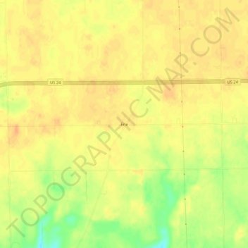
Name: Erie topographic map, elevation, terrain.
Location: Erie, Miami County, Indiana, United States (40.78115 -86.01138 40.82115 -85.97138)
Average elevation: 784 ft
Minimum elevation: 702 ft
Maximum elevation: 817 ft
Miami County trails, hiking, mountain biking, running and outdoor activities
Other topographic maps
Click on a map to view its topography, its elevation and its terrain.
Grissom Air Reserve Base
United States > Indiana > Miami County
Upon receiving the Letter of Intent on 28 March 1942, Russell B. Moore Company established a temporary headquarters and moved personnel and necessary drafting, surveying and office equipment and supplies to an old schoolhouse at Bunker Hill, which they occupied until completion of the Construction Engineering…
Average elevation: 801 ft