Geolocate

Cumnock topographic map

Click on the map to display elevation.

About this map

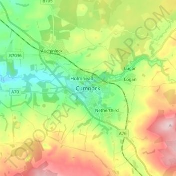
Name: Cumnock topographic map, elevation, terrain.

Location: Cumnock, East Ayrshire, Scotland, KA18 1AY, United Kingdom (55.41406 -4.30610 55.49406 -4.22610)

Average elevation: 614 ft

Minimum elevation: 289 ft

Maximum elevation: 1,086 ft

Other topographic maps

Click on a map to view its topography, its elevation and its terrain.

Braid Wood

United Kingdom > Scotland > East Ayrshire

Average elevation: 374 ft

Glenbuck Loch

United Kingdom > Scotland > East Ayrshire

Average elevation: 1,073 ft

Loch Doon

United Kingdom > Scotland > East Ayrshire

Average elevation: 955 ft

River Doon

United Kingdom > Scotland > East Ayrshire > Dalrymple

Average elevation: 551 ft

River Ayr

United Kingdom > Scotland > East Ayrshire

Average elevation: 689 ft

Gear up for your next adventure:

🎒Trail Energy Bars - High‑calorie bars for hiking energy
🏕️Family Camping Gear - Essentials for group camping trips
🛏️Cold Weather Sleeping Bag - Warm sleeping bag for cold conditions
🎒Waterproof Dry Bags - Keep your electronics and maps dry inside your pack
Solar GPS Watches - Advanced multisport watches with built-in topographic maps

As an Amazon Associate, this site earns from qualifying purchases at no extra cost to you.