
Tammun topographic map
Click on the map to display elevation.
About this map
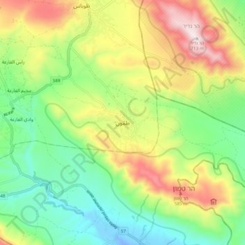
Name: Tammun topographic map, elevation, terrain.
Location: Tammun, Area A, West Bank, Palestinian Territory (32.24275 35.34478 32.32275 35.42478)
Average elevation: 912 ft
Minimum elevation: -92 ft
Maximum elevation: 2,333 ft
Other topographic maps
Click on a map to view its topography, its elevation and its terrain.
Meithalun
Palestinian Territory > Area A
The town is situated along the western edge of Marj Sanur, a valley and seasonal lake. It is the largest locality, of seven total, bordering Marj Sanur and controls the largest share of its fertile lands. It has an average elevation of 385 meters above sea level and is not elevated from its immediate…
Average elevation: 1,322 ft