Geolocate

Willard topographic map

Click on the map to display elevation.

About this map

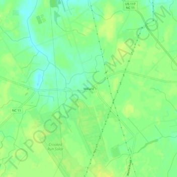
Name: Willard topographic map, elevation, terrain.

Location: Willard, Pender County, North Carolina, United States (34.67017 -77.99971 34.71017 -77.95971)

Average elevation: 52 ft

Minimum elevation: 20 ft

Maximum elevation: 72 ft

Pender County trails, hiking, mountain biking, running and outdoor activities

Other topographic maps

Click on a map to view its topography, its elevation and its terrain.

Surf City

United States > North Carolina > Pender County

Average elevation: 33 ft

Watha

United States > North Carolina > Pender County

Average elevation: 56 ft

Gear up for your next adventure:

🧭Map Reading Tools - Tools and kits for map navigation
🚁Photography Drones - Capture stunning aerial views of landforms and topography
🥄Camping Utensil Set - Lightweight utensils for outdoor meals
🧭GPS Watch Accessories - Bands and chargers for GPS watches
🏕️Tent Footprint - Protect your tent base from wear

As an Amazon Associate, this site earns from qualifying purchases at no extra cost to you.