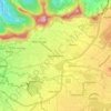
Moka topographic map
Click on the map to display elevation.
Moka
Moka (Mauritian Creole pronunciation: [moka]) is a village in Mauritius located mainly in the Moka District. The western part of the village lies in the Plaines Wilhems District. Since 1967 it forms part of Constituency No. 8 Quartier Militaire and Moka. The village is administered by the Moka Village Council under the aegis of the Moka District Council. According to the census made by Statistics Mauritius in 2011, the population was at 8,846. The elevation is 203 meters and can be up to 425 meters in some places. Moka is directly on the other side of the Moka Range from Port Louis. The village is close to the mountain Le Pouce and the town Beau-Bassin Rose-Hill. Réduit is a suburb of the village where the State House and University of Mauritius is situated. The village is also home to the Mauritius Broadcasting Corporation and the Mahatma Gandhi Institute.
About this map

Name: Moka topographic map, elevation, terrain.
Location: Moka, Mauritius (-20.25158 57.47433 -20.20542 57.53319)
Average elevation: 1,086 ft
Minimum elevation: 289 ft
Maximum elevation: 2,247 ft
Other topographic maps
Click on a map to view its topography, its elevation and its terrain.


Moka
Mauritius > Moka > Moka VCA, East
Moka (Mauritian Creole pronunciation: [moka]) is a village in Mauritius located mainly in the Moka District. The western part of the village lies in the Plaines Wilhems District. Since 1967 it forms part of Constituency No. 8 Quartier Militaire and Moka. The village is administered by the Moka Village Council…
Average elevation: 991 ft