
Thank you for supporting this site ❤️
Make a donation
Make a donation
Gear up for your next adventure:
As an Amazon Associate, this site earns from qualifying purchases at no extra cost to you.
Jetmore topographic map
Click on the map to display elevation.
Thank you for supporting this site ❤️
Make a donation
Make a donation
Gear up for your next adventure:
As an Amazon Associate, this site earns from qualifying purchases at no extra cost to you.
About this map
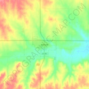
Name: Jetmore topographic map, elevation, terrain.
Location: Jetmore, Hodgeman County, Kansas, 67854, United States (38.04451 -99.93367 38.12451 -99.85367)
Average elevation: 2,343 ft
Minimum elevation: 2,224 ft
Maximum elevation: 2,474 ft
Hodgeman County trails, hiking, mountain biking, running and outdoor activities
Thank you for supporting this site ❤️
Make a donation
Make a donation
Gear up for your next adventure:
As an Amazon Associate, this site earns from qualifying purchases at no extra cost to you.