Geolocate

Jetmore topographic maps

Click on a map to view its topography, its elevation and its terrain.
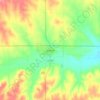
Jetmore

United States > Kansas > Hodgeman County > Jetmore > Jetmore

Average elevation: 2,343 ft

Gear up for your next adventure:

🪶Fire Starter Kit - Reliable fire starter for survival and camping
🏫Relief Map Kits - Hands-on tools for teaching landforms and elevation
🧤Hiking Gloves - Protective gloves for rugged trails
🛠️Backpacking Tool Kit - Essential toolkit for outdoor repairs
🦺Reflective Outdoor Gear - Safety gear for low‑light conditions

As an Amazon Associate, this site earns from qualifying purchases at no extra cost to you.