
Make a donation
Gear up for your next adventure:
As an Amazon Associate, this site earns from qualifying purchases at no extra cost to you.
Friedrichsdorf topographic map
Click on the map to display elevation.
Make a donation
Gear up for your next adventure:
As an Amazon Associate, this site earns from qualifying purchases at no extra cost to you.
Friedrichsdorf
Geografisch liegt Friedrichsdorf am Ostrand der westfälischen Bucht südwestlich des Teutoburger Waldes auf einer Höhe von 100 m ü. NN. Angrenzende Orte sind nord und nordöstlich die Bielefelder Stadtteile Senne, Ummeln und Brackwede sowie südwestlich der ebenfalls zu Gütersloh gehörende Ort Avenwedde. Im Westen grenzt Friedrichsdorf weiterhin an den Gütersloher Stadtteil Isselhorst.
Make a donation
Gear up for your next adventure:
As an Amazon Associate, this site earns from qualifying purchases at no extra cost to you.
About this map
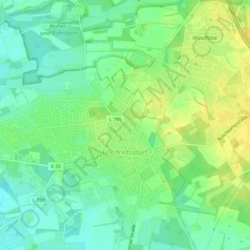
Name: Friedrichsdorf topographic map, elevation, terrain.
Average elevation: 335 ft
Minimum elevation: 295 ft
Maximum elevation: 374 ft
Make a donation
Gear up for your next adventure:
As an Amazon Associate, this site earns from qualifying purchases at no extra cost to you.
Other topographic maps
Click on a map to view its topography, its elevation and its terrain.
Siedlung Determeyer
Deutschland > Nordrhein-Westfalen > Kreis Gütersloh > Gütersloh
Average elevation: 272 ft