
Make a donation
Gear up for your next adventure:
As an Amazon Associate, this site earns from qualifying purchases at no extra cost to you.
Sheridan Lake topographic map
Click on the map to display elevation.
Make a donation
Gear up for your next adventure:
As an Amazon Associate, this site earns from qualifying purchases at no extra cost to you.
About this map
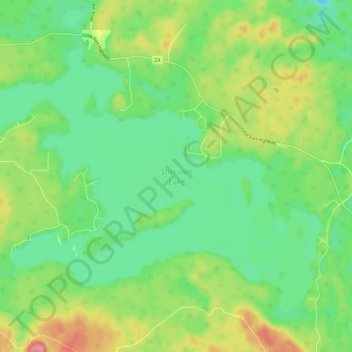
Name: Sheridan Lake topographic map, elevation, terrain.
Average elevation: 3,698 ft
Minimum elevation: 3,593 ft
Maximum elevation: 3,885 ft
Make a donation
Gear up for your next adventure:
As an Amazon Associate, this site earns from qualifying purchases at no extra cost to you.
Other topographic maps
Click on a map to view its topography, its elevation and its terrain.
Lone Butte
Canada > British Columbia > Cariboo Regional District > Area L (Lone Butte/Interlakes)
The northward advance of the Pacific Great Eastern Railway (PGE) rail head passed through Lone Butte in late April 1919. This construction camp had a large kitchen employing 25 cooks, of whom two received the Distinguished Conduct Medal and three the Military Medal during World War I. At an elevation of about…
Average elevation: 3,802 ft
Deka Lake
Canada > British Columbia > Cariboo Regional District > Area L (Lone Butte/Interlakes)
Average elevation: 3,743 ft
Interlakes
Canada > British Columbia > Cariboo Regional District > Area L (Lone Butte/Interlakes)
Average elevation: 3,694 ft