
Make a donation
Gear up for your next adventure:
As an Amazon Associate, this site earns from qualifying purchases at no extra cost to you.
Bekenes topographic map
Click on the map to display elevation.
Make a donation
Gear up for your next adventure:
As an Amazon Associate, this site earns from qualifying purchases at no extra cost to you.
About this map
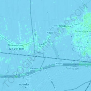
Name: Bekenes topographic map, elevation, terrain.
Location: Bekenes, Woerden, Utrecht, Nederland, 3449 HK, Nederland (52.05801 4.81425 52.09801 4.85425)
Average elevation: -3 ft
Minimum elevation: -13 ft
Maximum elevation: 10 ft
Make a donation
Gear up for your next adventure:
As an Amazon Associate, this site earns from qualifying purchases at no extra cost to you.
Other topographic maps
Click on a map to view its topography, its elevation and its terrain.
Woerden
Woerden stamt uit de Romeinse tijd, toen rond 41 n.Chr. het castellum Laurium op deze plek werd gesticht, op een natuurlijke hoogte. Dit castellum was een legerplaats langs de noordgrens van het Romeinse Rijk, die gevormd werd door de Rijn, tegenwoordig de Oude Rijn. Laurium is in gebruik geweest tot omstreeks…
Average elevation: -3 ft
Leidsche Rijn
In de loop van de geschiedenis worden als antwoord hierop verschillende maatregelen genomen, waarvan het graven van de Vleutense Vaart omstreeks 700 de eerste is. Dit kanaal begint in de rivier de Rijn dicht bij het huidige Utrechtse Domplein. Na ruim 4 km eindigt het in dezelfde rivier ter hoogte van Den…
Average elevation: 0 ft
Make a donation
Gear up for your next adventure:
As an Amazon Associate, this site earns from qualifying purchases at no extra cost to you.