
Make a donation
Gear up for your next adventure:
As an Amazon Associate, this site earns from qualifying purchases at no extra cost to you.
Dongcheng District topographic map
Click on the map to display elevation.
Make a donation
Gear up for your next adventure:
As an Amazon Associate, this site earns from qualifying purchases at no extra cost to you.
Dongcheng District
Like most of Beijing, the district is consistently level, with an elevation of 30–50 metres (98–164 ft) above sea level, reflecting the city's location on the North China Plain. There are a few significant bodies of water, all lakes in parks—Liuyin Lake in that park and Youth Lake in Qingnianhu Park, both in the district's northern portion, and Dragon Lake in Longtan Park at the district's southeast corner. On the west central edge is the moat surrounding the Forbidden City. The Nanchang River, heavily channelized from its days as the once-walled city's north moat, flows across the district's north, with the South Moat paralleling the 2nd Ring Road along its southern boundary. Along the southern edge of the Forbidden City another small stream, the Changpu River, flows above ground for a kilometer.
Make a donation
Gear up for your next adventure:
As an Amazon Associate, this site earns from qualifying purchases at no extra cost to you.
About this map
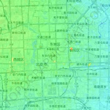
Name: Dongcheng District topographic map, elevation, terrain.
Location: Dongcheng District, Beijing, 100010, China (39.85716 116.37227 39.97265 116.44468)
Average elevation: 154 ft
Minimum elevation: 112 ft
Maximum elevation: 315 ft
Make a donation
Gear up for your next adventure:
As an Amazon Associate, this site earns from qualifying purchases at no extra cost to you.
Other topographic maps
Click on a map to view its topography, its elevation and its terrain.
Beijing
Beijing is situated at the northern tip of the roughly triangular North China Plain, which opens to the south and east of the city. Mountains to the north, northwest and west shield the city and northern China's agricultural heartland from the encroaching desert steppes. The northwestern part of the…
Average elevation: 154 ft
Make a donation
Gear up for your next adventure:
As an Amazon Associate, this site earns from qualifying purchases at no extra cost to you.
Make a donation
Gear up for your next adventure:
As an Amazon Associate, this site earns from qualifying purchases at no extra cost to you.
Make a donation
Gear up for your next adventure:
As an Amazon Associate, this site earns from qualifying purchases at no extra cost to you.
Make a donation
Gear up for your next adventure:
As an Amazon Associate, this site earns from qualifying purchases at no extra cost to you.
Make a donation
Gear up for your next adventure:
As an Amazon Associate, this site earns from qualifying purchases at no extra cost to you.
Make a donation
Gear up for your next adventure:
As an Amazon Associate, this site earns from qualifying purchases at no extra cost to you.
Make a donation
Gear up for your next adventure:
As an Amazon Associate, this site earns from qualifying purchases at no extra cost to you.