
Raung topographic map
Interactive map
Click on the map to display elevation.
About this map
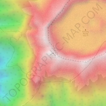
Name: Raung topographic map, elevation, terrain.
Location: Raung, Bondowoso, Jatim, Indonésie (-8.12562 114.04662 -8.12552 114.04672)
Average elevation: 9,213 ft
Minimum elevation: 6,444 ft
Maximum elevation: 10,778 ft
Other topographic maps
Click on a map to view its topography, its elevation and its terrain.
Banjarmendalan
Indonésie > Jatim > Banjarmendalan
Banjarmendalan, Lamongan, Jatim, 62211, Indonésie
Average elevation: 20 ft
Malang Plain
Malang Plain, Malang, Jatim, 65138, Indonésie
Average elevation: 1,972 ft
Probolinggo
Indonésie > Jatim > Probolinggo
Probolinggo, Jatim, 62719, Indonésie
Average elevation: 187 ft
Penanggungan
Penanggungan, Mojokerto, Jatim, Indonésie
Average elevation: 2,995 ft