Geolocate

Lexington topographic map

Click on the map to display elevation.

About this map

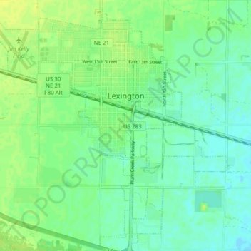
Name: Lexington topographic map, elevation, terrain.

Location: Lexington, Dawson County, Nebraska, 68850, United States (40.74308 -99.78704 40.80077 -99.71096)

Average elevation: 2,395 ft

Minimum elevation: 2,372 ft

Maximum elevation: 2,421 ft

Dawson County trails, hiking, mountain biking, running and outdoor activities

Other topographic maps

Click on a map to view its topography, its elevation and its terrain.

Lexington

United States > Nebraska > Dawson County > Lexington

Average elevation: 2,470 ft

Gear up for your next adventure:

🔋Rechargeable Batteries - Power up your outdoor devices
🦺Reflective Outdoor Gear - Safety gear for low‑light conditions
🌡️Handheld Weather Meters - Measure wind, temp, and pressure for safe mountain travel
🪑Ultralight Camp Chairs - Portable seating for resting after a long day of mapping
🖼️Topo Map Wall Art - Decorative topographic prints of famous peaks and regions

As an Amazon Associate, this site earns from qualifying purchases at no extra cost to you.