
卫城镇 topographic map
Interactive map
Click on the map to display elevation.
About this map
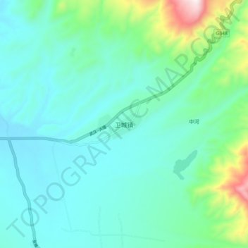
Name: 卫城镇 topographic map, elevation, terrain.
Location: 卫城镇, 盐源县, 凉山彝族自治州, 四川省, 中国 (27.41412 101.60546 27.49412 101.68546)
Average elevation: 8,366 ft
Minimum elevation: 7,864 ft
Maximum elevation: 10,551 ft
Other topographic maps
Click on a map to view its topography, its elevation and its terrain.