Geolocate

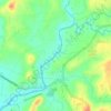
Lumbangan topographic map

Click on the map to display elevation.

About this map

Name: Lumbangan topographic map, elevation, terrain.

Location: Lumbangan, Tuy, Batangas, Calabarzon, Philippines (14.00448 120.69497 14.04448 120.73497)

Average elevation: 223 ft

Minimum elevation: 82 ft

Maximum elevation: 348 ft

Other topographic maps

Click on a map to view its topography, its elevation and its terrain.
Luna

Philippines > Batangas > Tuy

Average elevation: 246 ft

Palico River

Philippines > Batangas > Tuy > Sabang > Palico

Average elevation: 131 ft

Gear up for your next adventure:

🔭Compact Binoculars - HD vision for scouting terrain and identifying distant landmarks
🧦Hiking Socks - Comfortable socks to prevent blisters on long hikes
💧Water Filtration Bottles - Safely drink from streams and lakes while exploring
🖼️Topo Map Wall Art - Decorative topographic prints of famous peaks and regions
🧢Sun Protection Hats - Wide-brimmed and UPF-rated hats for high-altitude sun safety

As an Amazon Associate, this site earns from qualifying purchases at no extra cost to you.