
Thank you for supporting this site ❤️
Make a donation
Make a donation
Gear up for your next adventure:
As an Amazon Associate, this site earns from qualifying purchases at no extra cost to you.
Nariokotome topographic map
Click on the map to display elevation.
Thank you for supporting this site ❤️
Make a donation
Make a donation
Gear up for your next adventure:
As an Amazon Associate, this site earns from qualifying purchases at no extra cost to you.
About this map
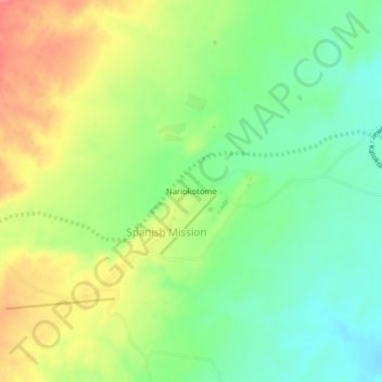
Name: Nariokotome topographic map, elevation, terrain.
Location: Nariokotome, Spanish Mission, Turkana County, Kenya (4.10648 35.83761 4.14648 35.87761)
Average elevation: 1,391 ft
Minimum elevation: 1,286 ft
Maximum elevation: 1,522 ft
Thank you for supporting this site ❤️
Make a donation
Make a donation
Gear up for your next adventure:
As an Amazon Associate, this site earns from qualifying purchases at no extra cost to you.