Geolocate

Port Said topographic map

Click on the map to display elevation.

About this map

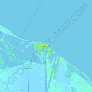
Name: Port Said topographic map, elevation, terrain.

Location: Port Said, 42531, Egypt (31.10324 32.14551 31.42324 32.46551)

Average elevation: 0 ft

Minimum elevation: -20 ft

Maximum elevation: 75 ft

Other topographic maps

Click on a map to view its topography, its elevation and its terrain.

History Garden

Egypt > Port Said > Port Said

Average elevation: 10 ft

Al-ʿAbbāsiyyah Canal

Egypt > Port Said

Average elevation: 52 ft

Gear up for your next adventure:

🥤Water Filter Bottle - All‑in‑one filter bottle for safe hydration
🧷Carabiner Set - Durable clips for gear attachment
🎒Outdoor Daypacks - Lightweight backpacks designed for carrying maps and essential gear
🚁Photography Drones - Capture stunning aerial views of landforms and topography
🌎3D Topographic Globes - Raised relief globes for a tactile understanding of geography

As an Amazon Associate, this site earns from qualifying purchases at no extra cost to you.