Geolocate

Thorong Phedi topographic map

Click on the map to display elevation.

About this map

Name: Thorong Phedi topographic map, elevation, terrain.

Location: Thorong Phedi, Neshyang-08, Neshyang, Manang, Gandaki Province, Nepal (28.75678 83.95265 28.79678 83.99265)

Average elevation: 16,302 ft

Minimum elevation: 14,111 ft

Maximum elevation: 18,622 ft

Other topographic maps

Click on a map to view its topography, its elevation and its terrain.
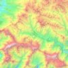
Neshyang

Nepal > Gandaki Province > Manang

Average elevation: 16,299 ft

Nashong

Nepal > Gandaki Province > Manang

Average elevation: 15,292 ft

Nashong

Nepal > Gandaki Province > Manang

Average elevation: 15,292 ft

Neshyang

Nepal > Gandaki Province > Manang

Average elevation: 16,299 ft

Neshyang-09

Nepal > Gandaki Province > Manang

Average elevation: 17,320 ft

Neshyang

Nepal > Gandaki Province > Manang

Average elevation: 16,299 ft

Gear up for your next adventure:

🥾Women's Hiking Boots - Top-rated trail boots with ankle support and superior grip
🔥Camping Stove - Portable stove for camping and backcountry cooking
🧦Hiking Socks - Comfortable socks to prevent blisters on long hikes
🔦Powerful Headlamps - Ultra-bright hands-free lighting for night navigation
🪶LED Camping Lantern - Bright lantern for camp lighting

As an Amazon Associate, this site earns from qualifying purchases at no extra cost to you.