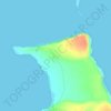
Santiago topographic map
Click on the map to display elevation.
Santiago
Santiago Island is one of the Galápagos Islands. The island, which consists of two overlapping volcanoes, has an area of 585 square kilometers (226 mi2) and a maximum altitude of 907 meters (2,976 ft), atop the northwestern shield volcano. The volcano in the island's southeast erupted along a linear fissure and is much lower. The oldest lava flows on the island date back to 750,000 years ago.
About this map
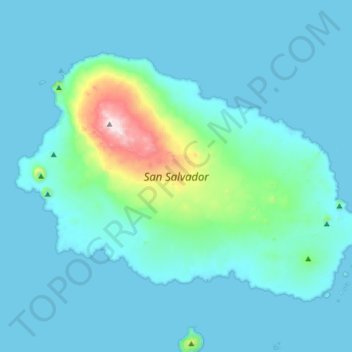
Name: Santiago topographic map, elevation, terrain.
Location: Santiago, Cantón Santa Cruz, Galápagos, Ecuador (-0.37548 -90.87103 -0.14487 -90.54639)
Average elevation: 266 ft
Minimum elevation: -3 ft
Maximum elevation: 2,979 ft
Other topographic maps
Click on a map to view its topography, its elevation and its terrain.

Isla Plaza Sur
Ecuador > Galápagos > Cantón Santa Cruz
South Plaza (Spanish: Isla Plaza Sur) is a small island off the east coast of Santa Cruz in the Galápagos Islands. It has an area of 0.13 km2 and a maximum altitude of 23 metres.
Average elevation: 16 ft
Isla Pinzón
Ecuador > Galápagos > Cantón Santa Cruz
Pinzón or Pinzon Island (Spanish: Isla Pinzón) is an island in Ecuador's Galápagos Archipelago. It has no permanent population, an area of 18 square kilometers (6.9 sq mi), and a maximum elevation of 458 meters (1,503 ft). Home to giant Galápagos tortoises of the subspecies Chelonoidis duncanensis and…
Average elevation: 407 ft