Geolocate

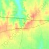
Monkstown topographic map

Click on the map to display elevation.

About this map

Name: Monkstown topographic map, elevation, terrain.

Location: Monkstown, Fannin County, Texas, United States (33.77318 -95.94797 33.81318 -95.90797)

Average elevation: 495 ft

Minimum elevation: 479 ft

Maximum elevation: 561 ft

Fannin County trails, hiking, mountain biking, running and outdoor activities

Other topographic maps

Click on a map to view its topography, its elevation and its terrain.

Bonham

United States > Texas > Fannin County

Average elevation: 604 ft

Leonard

United States > Texas > Fannin County

Average elevation: 689 ft

Ladonia

United States > Texas > Fannin County

Average elevation: 584 ft

Bonham

United States > Texas > Fannin County

Average elevation: 604 ft

Indian Creek

United States > Texas > Fannin County > Trenton

Average elevation: 712 ft

Honey Grove

United States > Texas > Fannin County

Honey Grove is in central North Texas, in eastern Fannin County, 16 miles (26 km) east of Bonham, the county seat, 39 miles (63 km) north of Greenville, 42 miles (68 km) east of Sherman, and 90 miles (140 km) northeast of the central business district of Dallas. Honey Grove was developed on flat to gently…

Average elevation: 640 ft

Ravenna

United States > Texas > Fannin County

Average elevation: 587 ft

Leonard

United States > Texas > Fannin County

Average elevation: 689 ft

Gear up for your next adventure:

⛺Backpacking Tent - Lightweight and durable tent for multi‑day hikes
🔥Plasma Lighters - Windproof lighters that work in any weather condition
🔥Camping Stove - Portable stove for camping and backcountry cooking
🛏️Cold Weather Sleeping Bag - Warm sleeping bag for cold conditions
🧤Hiking Gloves - Protective gloves for rugged trails

As an Amazon Associate, this site earns from qualifying purchases at no extra cost to you.