Geolocate

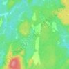
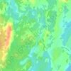
Lavant Station topographic map

Click on the map to display elevation.

About this map

Name: Lavant Station topographic map, elevation, terrain.

Location: Lavant Station, Lanark Highlands, Lanark County, Eastern Ontario, Ontario, Canada (45.04164 -76.70465 45.04567 -76.70022)

Average elevation: 902 ft

Minimum elevation: 810 ft

Maximum elevation: 1,056 ft

Other topographic maps

Click on a map to view its topography, its elevation and its terrain.
Flower Station

Canada > Ontario > Lanark County > Lanark Highlands

Average elevation: 768 ft

Lavant

Canada > Ontario > Lanark County > Lanark Highlands

Average elevation: 968 ft

Folger

Canada > Ontario > Lanark County > Lanark Highlands

Average elevation: 886 ft

Darling

Canada > Ontario > Lanark County > Lanark Highlands

Average elevation: 666 ft

Watsons Corners

Canada > Ontario > Lanark County > Lanark Highlands

Average elevation: 630 ft

Middleville

Canada > Ontario > Lanark County > Lanark Highlands

Average elevation: 600 ft

Lanark Township

Canada > Ontario > Lanark County > Lanark Highlands

Average elevation: 577 ft

Tatlock

Canada > Ontario > Lanark County > Lanark Highlands

Average elevation: 650 ft

Lanark

Canada > Ontario > Lanark County > Lanark Highlands

Average elevation: 502 ft

Gear up for your next adventure:

🛡️Bear Spray Outdoor - Protection in bear country hikes
🔭Compact Binoculars - HD vision for scouting terrain and identifying distant landmarks
🔥Camping Stove - Portable stove for camping and backcountry cooking
🌄Hiking Binoculars - Compact binoculars for scenic views and trail spotting
🥾Hiking Shoes - Durable and comfortable shoes for trail hiking

As an Amazon Associate, this site earns from qualifying purchases at no extra cost to you.