Geolocate
👉 Easily get elevation data in JSON, GeoTIFF and KML formats using Elevation API
Thank you for supporting this site ❤️
Make a donation

Lenzari topographic map

Click on the map to display elevation.

About this map

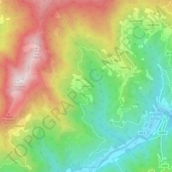
Name: Lenzari topographic map, elevation, terrain.

Location: Lenzari, Vessalico, Provincia di Imperia, Liguria, Italy (44.04474 7.93920 44.08474 7.97920)

Average elevation: 1,827 ft

Minimum elevation: 469 ft

Maximum elevation: 3,593 ft

Gear up for your next adventure:

Backpacking Tents - Weight-optimized shelters for multi-day topographic surveys
🪶Paracord Bracelet - Survival bracelet with built‑in tools
🔥Camping Stove - Portable stove for camping and backcountry cooking
🪶Fire Starter Kit - Reliable fire starter for survival and camping
🛏️Cold Weather Sleeping Bag - Warm sleeping bag for cold conditions

As an Amazon Associate, this site earns from qualifying purchases at no extra cost to you.