
Pumpkin topographic map
Click on the map to display elevation.
About this map
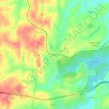
Name: Pumpkin topographic map, elevation, terrain.
Location: Pumpkin, Paulding County, Georgia, 30123, United States (33.90871 -84.91522 33.94871 -84.87522)
Average elevation: 984 ft
Minimum elevation: 846 ft
Maximum elevation: 1,135 ft
Paulding County trails, hiking, mountain biking, running and outdoor activities
Other topographic maps
Click on a map to view its topography, its elevation and its terrain.
Dallas
United States > Georgia > Paulding County
On April 4, 1977, near the site marker for the Battle of New Hope Church, the forced landing of Southern Airways Flight 242 occurred. The passenger jetliner, a McDonnell Douglas DC-9 with 81 passengers and 4 crew members, was flying from Northwest Alabama Regional Airport to Atlanta Municipal Airport. Upon…
Average elevation: 1,007 ft