
Watchfield topographic map
Click on the map to display elevation.
About this map
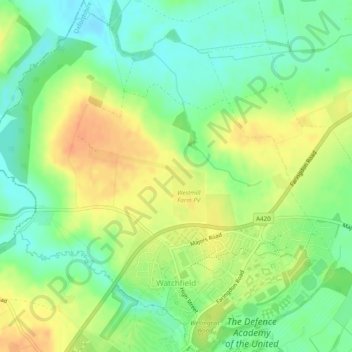
Name: Watchfield topographic map, elevation, terrain.
Average elevation: 318 ft
Minimum elevation: 256 ft
Maximum elevation: 384 ft
Other topographic maps
Click on a map to view its topography, its elevation and its terrain.
Harrowdown Hill
United Kingdom > England > Oxfordshire > Vale of White Horse
Average elevation: 243 ft
Lamborough Hill
United Kingdom > England > Oxfordshire > Vale of White Horse > Dry Sandford > Lamborough Hill
Average elevation: 302 ft