Geolocate

Hilgard topographic map

Click on the map to display elevation.

About this map

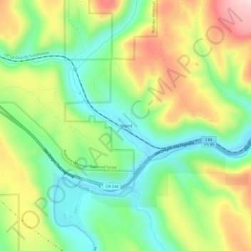
Name: Hilgard topographic map, elevation, terrain.

Location: Hilgard, Union County, Oregon, United States (45.33207 -118.24800 45.37207 -118.20800)

Average elevation: 3,389 ft

Minimum elevation: 2,963 ft

Maximum elevation: 4,035 ft

Union County trails, hiking, mountain biking, running and outdoor activities

Other topographic maps

Click on a map to view its topography, its elevation and its terrain.

La Grande

United States > Oregon > Union County

Average elevation: 2,910 ft

Cove

United States > Oregon > Union County

Average elevation: 2,966 ft

Elgin

United States > Oregon > Union County

Average elevation: 2,736 ft

Gear up for your next adventure:

🏫Relief Map Kits - Hands-on tools for teaching landforms and elevation
🧭GPS Watch Accessories - Bands and chargers for GPS watches
🔭Telescopic Hiking Pole - Adjustable pole for hiking stability
🪑Ultralight Camp Chairs - Portable seating for resting after a long day of mapping
🦺Reflective Outdoor Gear - Safety gear for low‑light conditions

As an Amazon Associate, this site earns from qualifying purchases at no extra cost to you.