Geolocate

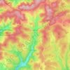
Oren topographic map

Click on the map to display elevation.

About this map

Name: Oren topographic map, elevation, terrain.

Location: Oren, Bernau im Schwarzwald, Verwaltungsverband St. Blasien, Landkreis Waldshut, Baden-Württemberg, 79872, Duitsland (47.76886 8.03548 47.76896 8.03558)

Average elevation: 3,474 ft

Minimum elevation: 3,087 ft

Maximum elevation: 3,980 ft

Other topographic maps

Click on a map to view its topography, its elevation and its terrain.

Waldshut

Duitsland > Baden-Württemberg > Landkreis Waldshut

Average elevation: 1,407 ft

Görwihl

Duitsland > Baden-Württemberg > Landkreis Waldshut

Average elevation: 2,536 ft

Todtmoos

Duitsland > Baden-Württemberg > Landkreis Waldshut

Average elevation: 3,205 ft

Todtmoos

Duitsland > Baden-Württemberg > Landkreis Waldshut

Average elevation: 3,205 ft

Jestetten

Duitsland > Baden-Württemberg > Landkreis Waldshut

Average elevation: 1,558 ft

Eggingen

Duitsland > Baden-Württemberg > Landkreis Waldshut

Average elevation: 1,755 ft

Gear up for your next adventure:

🛡️Insect Repellent - Protection against bugs during outdoor activities
🛰️Handheld GPS Units - Professional satellite navigators for precise backcountry mapping
🚁Photography Drones - Capture stunning aerial views of landforms and topography
📡Handheld GPS Device - Reliable handheld GPS for outdoor navigation
📌Outdoor GPS Map App - Apps and devices for digital topographic navigation

As an Amazon Associate, this site earns from qualifying purchases at no extra cost to you.