
Hazelbury Bryan topographic map
Click on the map to display elevation.
About this map
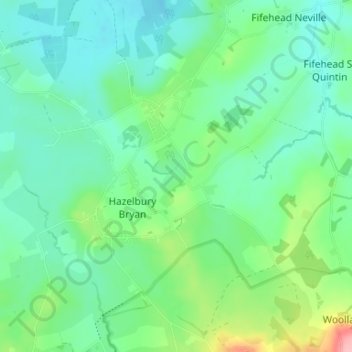
Name: Hazelbury Bryan topographic map, elevation, terrain.
Location: Hazelbury Bryan, Dorset, England, United Kingdom (50.86208 -2.38940 50.89555 -2.32343)
Average elevation: 299 ft
Minimum elevation: 200 ft
Maximum elevation: 594 ft
Other topographic maps
Click on a map to view its topography, its elevation and its terrain.
River Frome
United Kingdom > England > Dorset > Maiden Newton > Frome Vauchurch
Average elevation: 433 ft
Denhay Hill or Jan's Hill
United Kingdom > England > Dorset > North Chideock
Average elevation: 226 ft
Middlemarsh
United Kingdom > England > Dorset > Glanvilles Wootton > Middlemarsh
Average elevation: 381 ft