
Conger Lake topographic map
Click on the map to display elevation.
About this map
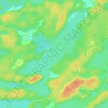
Name: Conger Lake topographic map, elevation, terrain.
Average elevation: 656 ft
Minimum elevation: 597 ft
Maximum elevation: 722 ft
Other topographic maps
Click on a map to view its topography, its elevation and its terrain.
Moon River
Canada > Ontario > Parry Sound District > The Archipelago Township
Average elevation: 607 ft
Pointe au Baril
Canada > Ontario > Parry Sound District > The Archipelago Township
Average elevation: 581 ft
Moon River
Canada > Ontario > Parry Sound District > The Archipelago Township
Average elevation: 607 ft
Deer Horn Island
Canada > Ontario > Parry Sound District > The Archipelago Township
Average elevation: 653 ft
Watt Island
Canada > Ontario > Parry Sound District > The Archipelago Township
Average elevation: 640 ft