Geolocate

Talihina topographic map

Click on the map to display elevation.

About this map

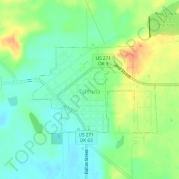
Name: Talihina topographic map, elevation, terrain.

Location: Talihina, LeFlore County, Oklahoma, United States (34.74613 -95.05234 34.75921 -95.02951)

Average elevation: 712 ft

Minimum elevation: 659 ft

Maximum elevation: 791 ft

LeFlore County trails, hiking, mountain biking, running and outdoor activities

Other topographic maps

Click on a map to view its topography, its elevation and its terrain.

High Top

United States > Oklahoma > LeFlore County

Average elevation: 1,453 ft

Cedar Knobb

United States > Oklahoma > LeFlore County > Pocola

Average elevation: 492 ft

Goats Bluff

United States > Oklahoma > LeFlore County

Average elevation: 587 ft

Leflore

United States > Oklahoma > LeFlore County > Le Flore

Average elevation: 574 ft

Page

United States > Oklahoma > LeFlore County

Average elevation: 1,273 ft

Hodgen

United States > Oklahoma > LeFlore County

Average elevation: 545 ft

Gear up for your next adventure:

🥾Men's Hiking Boots - Durable, waterproof footwear for rugged terrain and steep inclines
🦟Ultrasonic Repellers - Create a bug-free zone at your camp or rest stop
📱Heavy-Duty Phone Cases - Drop-proof and waterproof protection for outdoor navigation
🔭Telescopic Hiking Pole - Adjustable pole for hiking stability
🔥Fast-Boil Camping Stoves - Efficient cooking systems for quick trail meals

As an Amazon Associate, this site earns from qualifying purchases at no extra cost to you.