
Crystal Falls topographic map
Click on the map to display elevation.
About this map
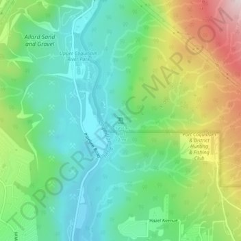
Name: Crystal Falls topographic map, elevation, terrain.
Average elevation: 725 ft
Minimum elevation: 194 ft
Maximum elevation: 1,804 ft
Other topographic maps
Click on a map to view its topography, its elevation and its terrain.
Town Centre Park
Canada > British Columbia > Metro Vancouver Regional District > Coquitlam
Average elevation: 203 ft
Blue Mountain Park
Canada > British Columbia > Metro Vancouver Regional District > Coquitlam
Average elevation: 390 ft
Mundy Park
Canada > British Columbia > Metro Vancouver Regional District > Coquitlam
Average elevation: 456 ft
Sheffield Park
Canada > British Columbia > Metro Vancouver Regional District > Coquitlam
Average elevation: 502 ft
Burke Mountain Pioneer Park
Canada > British Columbia > Metro Vancouver Regional District > Coquitlam
Average elevation: 423 ft