Geolocate

Port Sydney topographic map

Click on the map to display elevation.

About this map

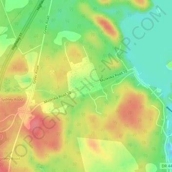
Name: Port Sydney topographic map, elevation, terrain.

Location: Port Sydney, Huntsville, District Municipality of Muskoka, Muskoka District, Central Ontario, Ontario, P0B 1L0, Canada (45.21090 -79.30357 45.23090 -79.28357)

Average elevation: 1,010 ft

Minimum elevation: 879 ft

Maximum elevation: 1,138 ft

Other topographic maps

Click on a map to view its topography, its elevation and its terrain.

Waseosa Lake

Canada > Ontario > Muskoka District > Huntsville

Average elevation: 1,161 ft

Mary Lake

Canada > Ontario > Muskoka District > Huntsville

Average elevation: 994 ft

Muskoka River

Canada > Ontario > Muskoka District > Huntsville

Average elevation: 1,037 ft

Fox Lake

Canada > Ontario > Muskoka District > Huntsville

Average elevation: 1,060 ft

Lake Vernon

Canada > Ontario > Muskoka District > Huntsville

Average elevation: 1,004 ft

Fairy Lake

Canada > Ontario > Muskoka District > Huntsville

Average elevation: 1,073 ft

Axe Lake

Canada > Ontario > Muskoka District > Huntsville

Average elevation: 1,070 ft

Gear up for your next adventure:

👖Convertible Hiking Pants - Versatile zip-off pants for changing altitudes and temperatures
🦺Reflective Outdoor Gear - Safety gear for low‑light conditions
🚗GPS Dash Cams - Record your scenic drives through mountain passes and canyons
🎒Trail Energy Bars - High‑calorie bars for hiking energy
📚USA Hiking Guide Books - Top trail guides and map books

As an Amazon Associate, this site earns from qualifying purchases at no extra cost to you.